A recent issue of Virginia Living magazine ran a feature I penned on the discovery of the site of Indian Chief Powhatan’s headquarters on the York River in Virginia. Its name is Werowocomoco, which in one interpretation means “the place of the antler wearers,” according to Martin Gallivan, anthropology department chair at William & Mary. A+A is pleased to post the article here today:
Randy Turner is a patient man. For nearly 30 years, the archeologist from the Virginia Department of Historic Resources was certain he knew the Gloucester County location of one of Virginia’s most elusive historic sites.
He just couldn’t set foot on it.
Turner surveyed a number of areas that surrounded his targeted site, but to no avail. It got to the point where he was run off from another site 25 miles away—with a shotgun—because he lacked permission to be there.
It was a teachable moment, one that affected how he approached his target going forward. “In 1973, I tried searching the site, but the owner wasn’t there and I had no access,” he says. “I’d periodically stop by to see if the owner was around, but it never happened.”
All that changed in 2002, when he got a call from Gloucester archeologists Dave Brown and Thane Harpole. “They said: ‘You’ve got to see this!’” he says.
They were talking excitedly about Bob and Lynn Ripley’s collection of artifacts—hundreds of them—dating from the 1400s to the early 1600s. For years, Lynn had walked the beaches and fields of their 300-acre York River property, picking up ceramic shards, pieces of stone tools, and small arrow tips. She’d collected so many that they turned their garage into a staging area, with drums and buckets and boxes so filled to the brim that they started cataloging each piece. They knew they were onto something.
“When I got there, it blew me away,” Turner says. “As an archeologist, I’m trained in scientific perspective, but this was one of the biggest moments of my career. It was very exciting.”
Lynn’s walks, it turned out, covered 50 acres that once served as Indian Chief Powhatan’s headquarters.
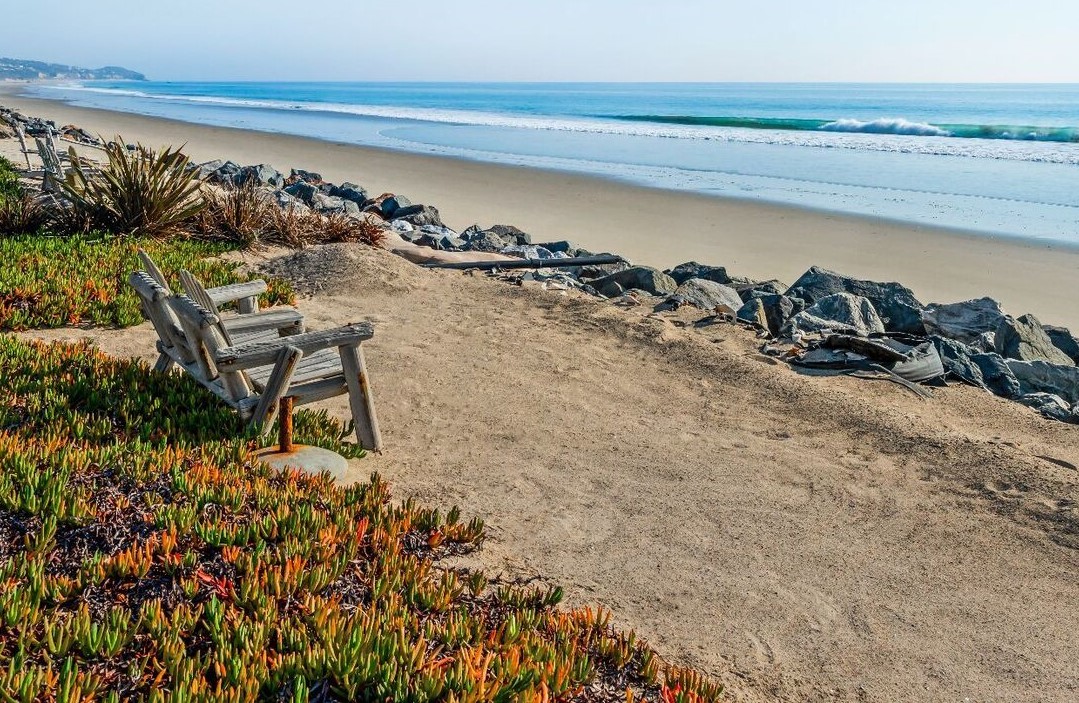
On the banks of Purtan Bay, the site is surrounded by water on three sides, about 15 miles up the York River from Yorktown. As Turner walked the elevated property, he was certain he’d found the Chief’s spiritual, military, and economic headquarters. “It was more or less as Powhatan left it, and largely untouched—but it was easy to visualize a Native American settlement there,” he says.
On it was a site later identified as the longhouse that precisely matches the place Captain John Smith identified in writings and maps, as Powhatan’s home. And if anyone would know, Smith would: he very well may have been brought there after his capture by Powhatan’s men in 1607.
Its name is Werowocomoco, which in one interpretation means “the place of the antler wearers,” according to Martin Gallivan, anthropology department chair at William & Mary. “They wore them during important religious ceremonies there,” he says.
Gallivan was invited to join Turner, Brown, Harpole, and Danielle Moretti-Langholtz in the Werowocomoco Research Group, formed to assess the potential for excavation there. The group asked for recommendations from the Virginia Council on Indians—a body established in 1982 to advise the governor and General Assembly on Indian affairs. “They were very supportive. We were the first to come to them with that kind of request,” Turner says. “It became a collaborative project.”
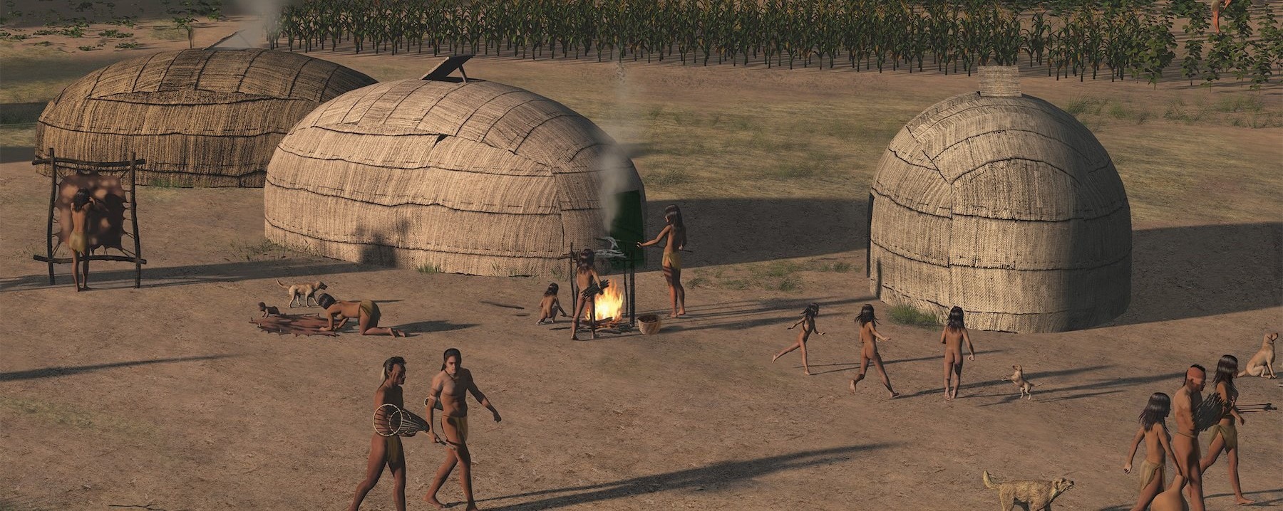
That’s because Powhatan presided over 15,000 of their ancestors, who once lived in 32 communities along the eastern part of the state. A god-like figure, Powhatan inherited six to eight Virginia districts, then expanded them through war, marriage, and intimidation. “He was a pretty powerful guy,” says Anne Richardson, current chief of the Rappahannock Tribe.
Werowocomoco was Powhatan’s center of power—his White House. There, from 2003-2010, Gallivan and his team excavated a number of deposits from riverfront homes dating to 1200 A.D. Then they found one twice the size of the others, about 1,000 feet from the water’s edge. “John Smith said it was 30-score from the river,” Gallivan says.
Copper fragments, matching the chemical makeup of copper found at Jamestown, were among the additional artifacts Gallivan found. Colonists traded copper with the Indians, who valued its shiny red hue as a prized sign of status. “It was used as a body adornment, like a pendant around the neck,” he says.
In one famous image of Chief Powhatan, he sits on an elevated platform in his longhouse, holding forth as those surrounding him listen. It’s likely where John Smith said Powhatan’s daughter, Pocahontas, intervened, saving him from being clubbed to death. “I’m not sure it happened as Smith described it, but if it did, it happened in the structure we found at the site,” he says.
Another interpretation of his rescue is “political theatre,” Gallivan suggests. “Powhatan was saying: ‘You’re now my son, and I want you to relocate Jamestown to here, where you’ll be safe, well taken care of, and part of my world.’” Smith was being initiated into the Powhatan community.
The myth of the fair maiden as rescuer is probably just that, according to Turner. “You didn’t hear about it until the other characters had died,” he says, “when no one was around to contradict him.” Still, Smith was a good negotiator, trading copper and beads for bushels of corn for the Jamestown settlers. “He was good at convincing people to help him,” Chief Richardson says. “He got natives to help map the territory, and he did a pretty accurate job with the actual locations of towns. That’s what he’s most known for.”
In 1609, Powhatan abandoned his York River settlement. “He wanted to distance himself from the colonists—as they would often show up unannounced, being only 15 miles away,” Gallivan says.
Native people may have continued to live on the site, or visit it, after Powhatan left, says Jody Couser of the Chesapeake Conservancy, a strong supporter of Werowocomoco. But by the 1650s, English families were living there, farming and harvesting timber, which continued for centuries.
In 2016, the Ripleys turned Werowocomoco over to the National Park Service (NPS), and it was placed on the National Register. Currently, the property is managed by the Captain John Smith Chesapeake National Historic Trail for the NPS.
“One day we’ll be very excited to welcome visitors to experience the fascinating history here,” says Cindy Chance, cultural anthropologist with the National Park Service. “But we’re early in that process. Right now, we’re doing the necessary research to protect these nationally significant resources.”
That research includes conducting a geophysical survey, using ground-pentrating radar and magnetometry to see what’s below the surface of the site, which is viewed with great reverence as a spiritual center. “It is a sacred place—you feel it when you step on that land,” says Chief Mark Custalow of the Mattaponi Reservation. When complete, the survey will have covered 55 acres of land.
Today’s Virginia tribe members are key players in determining Werowocomoco’s future. “I take my cues from seven tribal nations and what’s important to them,” says Chance.
The Park Service will conduct its first field trip with tribal families and later, Gloucester County Public Schools. “We may be ready to test this summer,” Chance says. “And we may be ready for the 2023-24 school year.” In addition, a tribal youth internship program, open to ages 18-35, is rebuilding connections to the land.
Remarkably, the excavations that took place between 2003-2010 covered less than five percent of Werowocomoco’s acreage. “We’ve only scratched the surface,” Turner says. “The National Park Service will have a ball over the next 100 years over what will be discovered.”
For more, go here.
 Anne Richardson, current chief of the Rappahannock Tribe in Virginia.